Sunday, 31 December 2017

Another year starteth

Hello 2017 and the start of our sixth year of "Monday Walks"


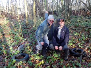
This blog is a list of walks done by Ivan, Richard & Trevor - mostly across Sussex and Kent but occasionally wider afield.

The three guys have been doing a "Monday Walk" for five years now and previous annual blogs can be found here ...


2016 Walks (3 men on a walk 2016)
 http://3amigoswalking2016.blogspot.co.uk/

2015 Walks (3 men on a walk 2015) http://3amigoswalking2015.blogspot.co.uk/

2014 Walks (3 Men on a walk - 2014)    http://www.3amigoswalking2014.blogspot.co.uk/

2013 Walks (3 men on a walk - 2013)     http://3amigoswalking.blogspot.co.uk/                    

2012 walks (Three men on a walk)    http://wealdway.blogspot.co.uk/        

At the end of each walk entry you will find full details of the route we took including a link to the route on Google Earth (a KML file) plus stats for the walk such as length; ascent and average speed. If you "click" on any picture it will enlarge and in some browsers, you can also step through all the photos in one go.

Enjoy reading our exploits and here's to continued good weather in 2017

Richard, Ivan & Trevor


Richard - Ivan - Trevor


Trevor - Richard - Ivan


Friday, 29 December 2017

2017 year round-up

Looking back at our walk efforts through 2017, it turned out to be another good year for our legs and constitution.

Looking at the core stats this is what we achieved...


Miles walked
416
Calories used
44,269
Altitude climbed
59,891
No. Walks done
            46


And comparing this with the previous 3 years (we didn't keep comparable stats for the 2012 when we started walking and 2013) shows ...

2014
2015
2016
2017
Miles
452
419
368
416
Calories
48,737
44,000
39,105
44,269
Altitude
43,690
45,223
42,156
59,891
No. Walks
47
41
37
46
Distance walked to
 Inverness
 Cairngorms National Park
 Dunfermline
 Pitlochry Cairngorms
Food days
19.5
17.6
15.6
17.7
Mount Everest climbs
1.51
1.56
1.45
2.06

And totaling up the last 4-years shows we have done...

Last 4 yrs total
Miles
1,655
Calories
176,111
Altitude
190,960
No. Walks
171
Distance walked to
Central Turkey
Food days
70.4
Mount Everest climbs
6.58

Our efforts in 2017 match up very well with previous years although in general we walked slightly shorter walks - our longest was 13 miles - we did do more of them. And we certainly found walks with big hills !


Lets hope us "Old Timers" can achieve a good set of results in 2018.

The Hartfield Dash!

Hartfield loop via Chuck Hatch and Pooh Bridge

 We thought it might be a good idea to squeeze in a walk between Christmas and New Year in an effort to lose a few calories from the recent excesses. However the weather had other ideas and we had to resort to our "Plan B" which was to meet up at "The Anchor" for a "Pie & a Pint" and if the weather passed over as forecast we would do a quick 6 mile loop in the afternoon just so we could go home with a smug smile on our faces. And that was what we did!

The Anchor is one of our favourite stopping points and today it was buzzing with families and dogs all having decided that the atmosphere in the Anchor was much better than the cold wet windy day outside! We met up there and enjoyed our lunch before booting up and setting forth on the trail.

There was a strong wind with a real cold edge to it but this loop had plenty of steady climbs on it and it wasn't hard to keep warm. However, as it had been raining very heavily in the four hours before it was very wet under-foot and also very slippery so in places we walked very carefully! Still this walk did the trick, gave us a good blow out and made us feel righteous even if we didn't lose many calories.

 
Two old codgers admiring the view
 
Sunshine after the rain

 
Dusk comes early at this time of year
 
Arriving back at the Anchor

Stats for the walk were...

Finished Hike: 29 Dec 2017, 15:40:48
Route: Hartfield Dash
Hike Time: 2:02:49
Stopped Time: 10:02
Distance: 5.87 miles
Average: 2.86 mile per hr
Fastest Pace: 15:30 min/mile
Ascent: 843 feet
Descent: 783 feet

Calories: 628

Monday, 18 December 2017

Crockenhill - Toys Hill Loop

Crockenhill common and around Chartwell

Our Last Monday walk of 2017 so we decided to try and lose a few ounces of weight before Christmas so we could add a lot more over Christmas. And the place to do it was up near Crockenhill and Toys hill as this part of the Weald has some very steep hills on it.

Parking up at Crockenhill Common we set foot towards Chartwell, the former home of Winston Churchill. Passing the cafe there we thought that a bacon Sandwich might help us on our way but a snooty lady at the counter said "Oh, we don't do those". So we had to go without a breakfast kick which was unfortunate because we knew we had to complete the full walk loop before taking lunch as there were no pubs on the walk.

It was cold - around 5 dec C - but with full winter sun so an ideal winter walk day. The path took us through a mixture of woodland and open fields as well as a couple of minor roads and throughout we had some great views.

 
The route
 
Great day for a walk
 
Looking out across the Weald
 
Chartwell hiding in the background as we walked through Chartwell Farm
 
What do you do when you find a car seat in the middle of a wood - sit on it!
 
Lunch at the Royal Oak in Crockenhill Village

Stats for the walk were...

Finished Hike: 18 Dec 2017, 16:00:47
Route: Crockenhill - Toys Hill
Hike Time: 2:29:35
Stopped Time: 16:18
Distance: 6.87 miles
Average: 2.75 mile per hr
Fastest Pace: 15:08 min/mile
Ascent: 1458 feet
Descent: 1446 feet

Calories: 766

Monday, 4 December 2017

Shipbourne loop again

Shipbourne Hadlow loop

Its nearing Christmas and the end of the year and we are getting lazy ! Well no one could think of a better walk and as Ivan wasn't with us when we walked it a few months ago we decided on a re-run. This walk was done in sunshine last time and so it was again today albeit it sun through high cloud with a sharp northerly wind. But still a great winter walk day.

Probably the only change to last time was that it being the run up to Christmas our watering hole, The Kentish Rifelman, was bustling by 12-30 and we had one of the last tables before diners were being turned away!

 
Starting out from Shipbourne Church
 
Wonderful winter sun across the Weald

Stats for the day were...

Finished Hike: 4 Dec 2017, 15:12:53
Route: Shipbourne loop again
Hike Time: 2:56:42
Stopped Time: 50:03
Distance: 8.45 miles
Average: 2.87 mile per hr
Fastest Pace: 14:49 min/mile
Ascent: 1662 feet
Descent: 1472 feet

Calories: 944

Monday, 27 November 2017

North downs ramble

Otford loop via the North Downs Way and Shoreham

Weather forecast was not good but as Monday morning approached the weather maps indicated that the band of rain would pass from the north. So if we delayed our start a bit and walked in the North of our catchment area we might just stay dry. Trevor picked up a route around the North Downs and with a bit of modification to suit our late timing that's where we headed.

We parked up at Otford and set out along the North Downs Way. There is a very steep uphill section out of Otford but once on the top of the downs and caught our breath and the rain stayed away. We had done some of this trail before but for several miles we found ourselves on new paths as we looped across the downs and eventually dropped down the steep side of the Darenth valley into Shoreham where we hoped to find one of the three pubs open for business. Luckily the Kings Arms was open and we popped in for refreshment before walking up the other side of the valley as we looped back to the car at Otford.


Our route but we added a couple of miles after lunch!


Looking over the Darenth valley from top of the downs


Up on the North Downs


An Egret fishing in the River Darenth


Heading along the Darenth valley towards Otford


Lunch Stop at the Kings Arms


Stats for the walk were...

Finished Hike: 27 Nov 2017, 14:28:52
Route: Otford Shoreham 
Hike Time: 2:54:11
Stopped Time: 57:49
Distance: 8.29 miles
Average: 2.85 mile per hr
Fastest Pace: 15:07 min/mile
Ascent: 1865 feet
Descent: 1899 feet

Calories: 913

Monday, 20 November 2017

A Morning on the Ashdown Forest

Ashdown 7.mile loop 


Ivan had to play Nurse on the afternoon and so we needed a local walk that we could finish by 12-30 so Ivan could go off to his husbandly duties. The Ashdown Forest is always good for a mornings walk being both near us and challenging so we met up at Kings Standing ready for the trek. Trevor and I were slightly disappointed to see that Ivan wasn't walking in his Nurses uniform but his excuse was that the suspenders would chaff his legs so we let him off.

It was a low cloud day but not wet and a sharp wind let you know that it was winter. The Ashdown Forest consits of several rolling valleys and any loop walk means that you will be walking downhill sometimes and uphill on others and our loop seemed to consist of a long downhill and an even longer uphill! Still it kept us fit and warm and we concluded the walk right on 12-30 so Ivan wouldn't be late for his duties. Trevor and I were in a much better situation so drove down the road to Groombridge and said hello to our old friend "The Crown Inn" - hard luck Ivan!

 
The route


Ashdown on a gloomy day
 
Ashdown Forest in winter
 
The Crown Inn

Stats for the walk were...

Finished Hike: 20 Nov 2017, 14:38:00
Route: Asdown 7m loop
Hike Time: 2:26:45
Stopped Time: 5:50
Distance: 6.71 miles
Average: 2.75 mile per hr
Fastest Pace: 17:32 min/mile
Ascent: 1136 feet
Descent: 1111 feet

Calories: 730

Monday, 13 November 2017

Devils Dyke on a cold bright Autumn day

Devils Dyke loop via Poynings and Saddlescombe

A cold frosty morning with a cold north wind but the bright sunshine made up for this and it was a perfect day for a winter walk. We parked up at one of the walkers car parks about a mile from Devils Dyke and set out southwards down the "Monarch's way".

Having walked downhill along the Monarch's way we then turned north up the Sussex Border path and this was a VERY long uphill pull for about 2 miles. Fortunately on reaching the top of the appropriately named "Fulking Hill" we could see our lunch stop at the Devils Dyke Inn a half-mile ahead. All along the ridge that makes up the Devils Dyke were Para-gliders because the north wind at about 15 mph was driving up and over the ridge affording excellent uplift for these flyers.

After an enjoyable lunch we continued northwards and this took us downhill again into the valley bottom as we reached the pretty village of Poynings. So once more what comes down has to go back up and three tired old walkers started the climb up to Saddlescombe and beyond to reach the car with very tired legs.

 
Looking South from that Fulking Hill !
 
Up on the Downs
 
DEvils Dyke escarpment
 
Hang Gliders using the updraft


Winter Woolies on for the first time this winter
 
Lunch Stop at the Devils Dyke Inn
 
Low sun as we approach our final mile

Stats for the day were ...

Finished Hike: 13 Nov 2017, 14:27:33
Route: Devils Dyke-1
Hike Time: 2:48:17
Stopped Time: 1:11:44
Distance: 8.59 miles
Average: 3.1 mile per hr
Fastest Pace: 13:53 min/mile
Ascent: 1430 feet
Descent: 1416 feet

Calories: 915

Monday, 6 November 2017

A trip to the seaside

Newhaven to Brighton along the coast path

Our wonderful Autumn weather continues and with sunshine and clear blue skies Trevor wanted a day at the seaside so we indulged him with a south coast trek that we have had on the cards for several months waiting for just such a lovely day.

We parked up at Newhaven and walked along the river Ouse to its mouth below the old Victorian fort. climbing up to the fort and then on to Castle hill. Great views east along to the coast to Seaford Head, and the Seven Sisters beyond. We were walking westward towards Brighton and the first few miles followed the top of the chalk cliffs.

Once we reached Peacehaven the path drops down the cliff to the shoreline and we walked along the sea defences for another two miles before climbing the cliff again to Telscombe. After another mile or so the path again drops down to sea level and from this point we stayed on the under-cliff path right the way to Brighton.

Fortunately, at Rottingdean there was an excellent watering hole at "The White Horse" and we sat having lunch outside in the sunshine looking out at the sea.

On reaching Brighton we caught the bus back to Newhaven and walked the mile or so back to the car.

 
Looking down from Fort Hill
 
Newhaven from Fort Hill
 
The Ouse delta with Seaford Head in the distance
 
Along the clifftop
 
Two likely lads walking the sea defences
 
The White Horse lunch-stop

Stats for the day were...

Finished Hike: 6 Nov 2017, 15:21:36
Route: Newhaven to Brighton
Hike Time: 3:25:57
Stopped Time: 1:40:47
Distance: 10.93 miles
Average: 3.17 mile per hr
Fastest Pace: 14:15 min/mile
Ascent: 1920 feet
Descent: 1863 feet

Calories: 1163