Monday, 27 March 2017

Penshurst to Chiddingstone loop

Penshurst - Chiddingstone - Chiddingstone Causeway - Penshurst

This was a lovely bright spring day but with just a little sting in the tail from the breeze. Ivan couldn't walk (some would say he doesn't do that anyway!) so Trevor and I decided to stay local especially as I had to be home by 3-00pm for another duty.

We had walked some of the paths before but even Trevor who was on his own stomping ground was delighted to find he was walking on "new ground". The plan was to complete the 7.8 mile loop; get back to the car then drive a short distance to whichever local pub we felt like. So that's what we did and ended up at the Fleur de Lis pub in Leigh for lunch.

This was a great walk on a beautiful day and we thoroughly enjoyed it.

 
Walking towards Chiddingstone Church
 
Penshurst Place Parkland with a great show of Daffodils
 
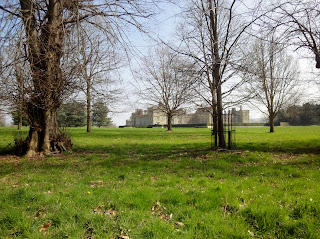
Penshurst Place Mansion
 
Lunch stop at the Fleur De Lis

Stats for the day were...

Finished Hike: 27 Mar 2017, 12:33:03
Route: Penshurst Chiddingstone
Hike Time: 2:16:36
Stopped Time: 22:29
Distance: 7.80 miles
Average: 3.43 mile per hr
Fastest Pace: 14:54 min/mile
Ascent: 661
Descent: 676

Calories: 778

Monday, 20 March 2017

East Malling dash to beat the rain

East Malling 7.5 mile Loop

We had hoped to kick off our start of walking the Meridian Way from the south Coast up to London but the forecast was not good. It showed high winds and rain across the middle of the day and so we decided to do a quick 7 mile loop around the Kent Fruit Farms hoping that we would complete it before the worst of the weather hit us. The plan worked well as the rain delayed itself for an hour or so and we were back in the pub for lunch before it hit us!

We had not walked in this sector before and started from the pretty village of East Malling. The path took us through the famous Malling Research Centre where fruit growing trials are conducted and new fruit varieties developed. We then walked through the Kent Coppice woods to the village of Barming (ignoring the stop at "The Bull" which we might have used if the rain came early!) and then looping back over the hill and back to East Malling where lunch awaited us at "The King & Queen". This was a new hostelry for us and very nice it was too.

 
Primroses are now fully out in the hedgerows so Spring must be upon us
 
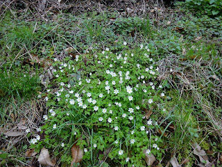
Likewise the Wood Anenomes
 
East Malling High Street
 
Lunch Stop - The King & Queen

Stats for the walk were ...

Finished Hike: 20 Mar 2017, 12:54:24
Route: East Malling Loop
Weather: 
temperature11°C
humidity94%
wind18 mph SSW
Hike Time: 2:28:02
Stopped Time: 4:18
Distance: 7.50 miles
Average: 3.02 mile per hr
Fastest Pace: 14:31 min/mile
Ascent: 1120
Descent: 1060

Calories: 797

Tuesday, 14 March 2017

Cissbury Ring Hill Fort and beyond

Cissbury Ring to Lower Beeding

We have wanted to take a look at Cissbury Ring, an old Iron-Age fort (see https://en.wikipedia.org/wiki/Cissbury_Ring ) for some time now but needed a good weather day to do it. This was the day and whilst the loop walk was a tough one on the legs at 12.5 miles it was well worth it.

We parked up at the car park about a mile below the top of the hill fort and walked up the steep hillside to the top of the South Downs, entering the fortifications on the southern side. The enormity of the defensive ditches almost a mile in circumference is amazing and to think it was all hand-dug with primitive tools.

We exited the ring on the east side and followed the path down until we picked up the South Downs Way which we followed all the way to Lower Beeding where the "Rising Sun" awaited our custom for lunch. This was a long walk and we had completed 7 miles before lunch! 


The route back took us through the very old village of Bramber with its derelict castle where we picked up the "Monarch's Way" national trail. A board told us that the Monarch's way approximates the escape route taken by King Charles II in 1651 after being defeated in the Battle of Worcester. It runs from Worcester via Bristol and Yeovil to Brighton. This trail took us back to the base of Cissbury Hill and we looped around the base of the hill and back to the car. This was one of the longest walks we have done for quite some time and it felt like it.

 
Entering the fort and looking back towards Worthing
 
Two Iron-Age men climbing the ramparts
 
One of the main defensive ditches
 
The defensive rampart and ditch that runs around the top of the hill
 
All done without a JCB Digger in sight!
 
The top of the hill has a commanding view of the area
 
Not quite clear enough to see the Seven Sisters Cliffs clearly
 
Wild ponies have been introduced to keep the scrub and gorse down
 
A welcome sight - our lunch stop
 
Bramber village with the castle in the background
 
Bramber Village
 
Not just free Range Children running amok here!
 
The Steyning Bowl loop on the Monach's way


Stats for the day were...

Finished Hike: 13 Mar 2017, 15:44:04
Route: Cissbury Ring
Hike Time: 5:06:39
Stopped Time: 14:46
Distance: 12.52 miles
Average: 2.7 mile per hr
Fastest Pace: 14:52 min/mile
Ascent: 2128
Descent: 2118
Calories: 1626

Monday, 6 March 2017

Up and over the hill for lunch

Plumpton to Lewes and back

Hills; We love them but big ones like todays need a BIG incentive for us old codgers and today it was the draw of an old friend - The John Harvey Tavern in Lewes. 

It was scheduled to be a dry day but windy and certainly up on the top of the South Downs the wind was both strong and biting. Fortunately on the way out we had the wind on our backs and so we enjoyed the occasional glimpse of the sun and the spectacular views. On our way back the wind in our faces made our eyes water but with the legs aching from the second big climb of the day we hardly noticed!

The climb up from Plumpton is exceptionally steep, straight up the north side of the Downs. But once the climb to 680 ft is made the views all around are magnificent. And today as we headed South East towards Lewes we had the benefit that the walk along this section of the South Downs Way was entirely downhill!

We entered the town and walked down to the River, using the smoking chimney of the "Harveys Brewery" as both a guide and a stimulant. The John Harvey Tavern sits directly across the road from the Brewery and is an old favourite watering hole for us.

After lunch we followed the Sussex Ouse path out of the town until the village of Offam where for the second time in the day we had to climb up to the top of the downs and re-join the South Downs Way. Finally we hit the "down" trail to Plumpton and arrived back to the car. At 11.3 miles this was our longest walk so far this year.

 
The view from above Plumpton Village
 
Ivan just checking that the Ordnance Survey had put the trig station in the right place on Black Cap Hill
 
Looking towards Lewes
 
Lewes nestled in the river valley
 
Lewes Castle
 
Walking along the river Ouse.

Stats for the day were...

Finished Hike: 6 Mar 2017, 15:18:49
Route: New Route
Weather: temperature 10°C
Humidity 81%
Wind 7 mph NNW
Hike Time: 3:52:27
Stopped Time: 57:02
Distance: 11.37 miles
Average: 2.92 mile per hr
Fastest Pace: 13:21 min/mile
Ascent: 1801
Descent: 1709

Calories: 1234