Monday, 27 February 2017

A quickie around Crowborough

Crowborough loop in the wet

It was a filthy weather forecast with strong wind and rain sweeping across our region in late morning. We met up at Ivan's house and spent a happy hour or so planning walks and then a quick look at the Internet weather map showed a small break in the rain - hopefully - so we donned the boots and walked down the road to the pub for lunch! 

Well it's not as bad as it seems because the pub was on the route and we needed to make sure the rain had passed. So 45 mins later we hot footed along the loop and for the first 3 miles the rain stayed away. Then we hit some showers including the odd bit of hail but generally it wasn't too bad and the 5.3 mile walk and its hills did us good.

 
Deer grazing alongside the forest


Daffodils are finally out - these were our first of the year in the wild


No electronic stats today as the machine failed. However, we know it was 5.3 miles from the map and we probably averaged our standard 3.0 mph especially after lunch!

Monday, 20 February 2017

Another North Downs Walk

Downe - Biggin Hill Loop

We really felt that Spring had arrived today as we walked in 17 deg Temperatures by the end of the walk and only one layer of clothing. Not wall to wall sunshine but breaks in the high cloud did give us a bathing in the golden stuff from time to time.

We have walked via Downe before but this trail was in a sector not trodden before and it turned out to be very pleasant with good paths and good signage. The North Downs are very different in topography to the South Downs and we found ourselves walking through woodland and open fields as well as steep valleys so this turned out to be a very good work-out.

We parked up at Cuckoo Wood, just north of Downe and set off on our anticlockwise route. It wasn't long before we reached the northern end of the Biggin Hill Airport runway and our path then led us south around and along the perimeter of the airport for about 2 miles. We then turned north to reach the village of Downe where we had a choice of two pubs for lunch! We chose the George & Dragon, a hostelry we have used before but not for a couple of years. It didn't disappoint.  

After lunch was a bit of a roller coaster as we crossed a couple of very steep valleys. We knew it was coming as we have walked this section before but it still makes the heart pound struggling up the hills. We convinced ourselves that this is good for us old men but it was nice to eventually reach the car again.

The bright spring day up on the N Downs


The village of Downe
 
Downe Village
 
Lunch Stop

Stats for the day were ...

Finished Hike: 20 Feb 2017, 14:48:12
Route: Downe - Biggin Hill loop
Weather: 
temperature14°C
humidity94%
wind10 mph W
Hike Time: 3:18:01
Stopped Time: 56:49
Distance: 9.71 miles
Average: 2.95 mile per hr
Fastest Pace: 13:38 min/mile
Ascent: 734
Descent: 837

Calories: 1012

Monday, 13 February 2017

Red House Common and beyond

Red House Common to Scaynes Hill loop

Hooray - it finally felt like Spring today. If it hadn't been for the cold wind it might have been an April day but the wind kept the temperature down to around 9 deg C. We didn't walk last week and so it was good to be out in the countryside again.

We headed towards North Chailey and parked up at a walkers car park at Red Hill Common. This is a new area of Sussex for us to walk in and it was very pleasant indeed. The common was a lovely upland heath area which gave us great views across the Sussex Weald.

This trail took us through a mix of open countryside and woodland and occasionally it was very soggy underfoot. Our on-route stop for lunch was scheduled to be "The Inn on the Green" at Scaynes Hill but yet again we found our chosen Pub Closed. Still we are only 2.5 miles from the end of the loop and so we hot-footed it around the rest of the loop and then drove to a delightful pub "The Bull Inn" in Newick. 

 
North Chailey Windmill
 
North Chailey Windmill
 
Red House Common
 
Lunch Stop in Newick

Stats for the day were ...

Finished Hike: 13 Feb 2017, 13:19:40
Route: Red House Common Loop
Weather: 
temperature8°C
humidity81%
wind12 mph E
Hike Time: 2:52:04
Stopped Time: 14:28
Distance: 8.31 miles
Average: 2.90 mile per hr
Fastest Pace: 15:15 min/mile
Ascent: 268
Descent: 280

Calories: 846

Monday, 30 January 2017

Along the Forest Trail

Groombridge to East Grinstead along the Forest Trail


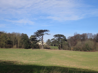
Not a very nice day with heavy cloud and the constant threat of light drizzle, although this never appeared and we actually had a dry walk. Heavy rain over the weekend led us away from the fields and we decided on a nice stroll along the old railway line trail that links Groombridge to East Grinstead. This path is well drained and not overly muddy and being pretty flat we can skip along it at a good pace.

We parked up at Groombridge and "Plan A" was to catch the 10-00am bus to East Grinstead then walk back to Hartfield to give our old friend "The Anchor" a look in. However, the bus failed to arrive - we think because it broke down on the inward journey - so we quickly put "Plan B" into action and started the walk the other way around going from Groombridge out to East Grinstead with a bus ride back home later.

Whilst this path is good underfoot it's not the most interesting having no hills and in places is perfectly straight for several miles. Still we made good time and had to wave at "The Anchor" as we passed it well before opening time. Our next target was to get to the great little town of Forest Row where we also knew of a watering hole, so at 12-45 we arrived at "The Coach and Horses" ready for a spot of lunch. This is a lovely pub but apart from us three there was only one other customer in it and it goes to show how hard it is for local publicans to make ends meet these days and why so many nice country pubs are closing down.

We could have caught a bus back from outside the pub but we decided to carry on and do the additional 3 miles to East Grinstead making this one of the longest walks we have done this winter. There is a moving statue in East Grinstead as a memorial to Sir Archie McIndoe, the famous pioneer of "Plastic Surgury" who did so much for the badly burnt and disfigured fighter pilots of WW2. (See Archibald_McIndoe ) Sir Archie set up his clinic in East Grinstead and whilst many of the airmen had severe disabilities and needed long-term treatment at the nearby hospital, the residents of East Grinstead took these men to heart and treated them as normal neighbours, buying them drinks in the local pubs and respecting the sacrifices they had made. Photo of the statue below shows Sir Archi with an RAF pilot.

 
Not difficult to guess this was once a Railway line


The Coach & Horses in Forest Row
 
The statue commemorating the work of Sir Archi McIndoe in East Grinstead

Stats for the day were ...

Finished Hike: 30 Jan 2017, 16:21:18
Route: Groombridge to East Grinstead
Weather: 
temperature8°C
humidity93%
wind5 mph N
Hike Time: 3:22:12
Stopped Time: 1:00:53
Distance: 10.89 miles
Average: 3.24 mile per hr
Fastest Pace: 15:06 min/mile
Ascent: 1445
Descent: 1173
Calories: 1160

Monday, 23 January 2017

Around Knockholt

Knockholt to Downe loop


A cold start after a very heavy frost but the day was scheduled to brighten up after early morning mist and that's what it did. With Ivan in bed with a heavy cold it was Trevor and myself that parked up at Knockholt for this 8.5 mile loop walk via Downe.

As the crow flies we were only about 20 miles from central London yet the countryside and almost wilderness of this sector of the North Downs is amazing. The trail took us through open fields, woodland and the occasional piece of farmland, all in peaceful seclusion.

As we approached Downe we saluted the one-time residence of Charles Darwin and the place he wrote his initial papers on the theory of evolution. We couldn't help but wonder why evolution hadn't yet given us a new set of stronger legs because the steepness of the valleys we were heading straight for were real tough on our ancient original versions.

We arrived to early at the village of Downe for lunch - two great pubs in this village - and with an ETA for completion of around 1-15ish we decided to push on and complete the loop and then visit the pub in Knockholt. As previously mentioned, this second half of the walk has three big hills to climb and we huffed and puffed at all of them but generally agreed we needed the exercise to finally rid ourselves of the Christmas excesses. It was indeed a good sight to see Knockholt church come into view because the car was parked just outside it!.

We changed out of the dirty walking boots and drove the half-mile into Knockholt to the pub for lunch only to find it closed on Mondays as was the second pub in the village. Still in Kent you are never more than a mile or two from a decent watering hole and as we drove through Chipstead we spotted the Bricklayers Arms and what a find it was too. A lovely old pub with a lively atmosphere, good food and good beer. We enjoyed our visit so much we thought about planning a walk sometime in that area just so we can sample the wares again!


A frosty walk on a bright day

 
The Bricklayers Arms in Chipstead

Stats for the walk were...

Finished Hike: 23 Jan 2017, 13:01:18
Route: Knockholt Downe loop
Weather: 
temperature6°C
humidity87%
wind6 mph WSW
Hike Time: 2:51:49
Stopped Time: 9:39
Distance: 8.41 miles
Average: 2.94 mile per hr
Fastest Pace: 14:41 min/mile
Ascent: 678
Descent: 697

Calories: 888

Monday, 16 January 2017

Another "Up & Over" the South Downs

Plumpton loop over the Downs


Despite relatively favourable weather forecasts the night before, it turned out to be a pretty "dirty" day with light drizzle and low cloud, especially up on the top of the hills. Still we decided to brave it and this was a walk in an area not really familiar with us and particularly the hike up the face of the Downs from the tiny village of Plumpton.

We parked up next to the village pub - always a good incentive to walk fast and complete the trek! - and immediately hit a trail which goes straight up the escarpment and doesn't take prisoners. This was one of the steepest climbs for many a month and at the top we entered mist from low cloud and patches of snow from the recent blizzard that passed over us last Thursday evening.

Once up on the crest our route took us gently down the southern relief before we turned west and then took the long slow climb back up to the northern rim again. a quick turn east along the South Downs Way took us back to the trail we had climbed up from the pub and so we quickly descended it again right into the door of the Half-Moon for lunch.


Climbing up the South Downs
 
The trail and the mist

What a wet weather walker looks like !

 
Up on the top of the Downs


Lunch Stop !

Stats for the route were...

Finished Hike: 16 Jan 2017, 13:04:30
Route: Plumpton Loop
Weather:
temperature4°C
humidity93%
wind5 mph E
Hike Time: 2:32:23
Stopped Time: 10:13
Distance: 7.33 miles
Average: 2.88 mile per hr
Fastest Pace: 14:19 min/mile
Ascent: 843
Descent: 830

Calories: 775

Monday, 9 January 2017

Around Groombridge to beat the rain

Groombridge loop


The only glimmer of hope in the weather forecast was to try and get some walking done by noon because a very cold, wet and windy weather front was slipping down across the UK and would reach us about lunchtime. So we planned for an early start - well 9-30 am is early in retirement - from a close location and that had to be Groombridge.

We quickly knocked out a 7.5 mile loop which is about 2.5 hrs walking and hoped that dear old Carol the weather lady had got her calculations right. As it happened she was spot on because we finished the loop at 12-15 and no sooner had our muddy boots been taken off when it started to rain.

The path took us along a couple of old favourites; The High Wealdway and the old railway track but at this time of year the muddy tracks get very sticky and slippery and today was no exception. Still we got in a decent dose of exercise on what didn't look like a promising day and once back at the car we were only a short hop to "The Crown" for lunch where it could rain as hard as it liked!

 
A grey winter day over the Weald


More grey

 
A ray of sunshine - The Crown at Groombridge
 
No rain in here!

Stats for the day were...

Finished Hike: 9 Jan 2017, 14:47:32
Route: Groombridge Loop 7.5
Weather: 
temperature10°C
humidity94%
wind8 mph SSW
Hike Time: 2:31:51
Stopped Time: 6:25
Distance: 7.53 miles
Average: 2.98 mile per hr
Fastest Pace: 14:08 min/mile
Ascent: 922
Descent: 889

Calories: 798

Wednesday, 4 January 2017

A leg-stretcher up the South Downs

Arlington to Alfriston - a two-peaks walk

Well as the first walk of 2017 and having not walked since before Christmas, we desperately needed to remove some of the seasons excesses and give the legs a good stretch. And the best place we know for doing that is our old friend the South Downs Way.

To make things a little different we parked up at Arlington Reservoir and walked from there to Wilmington and up the North face of the South Downs.  As soon as we reached the top we reached the South Downs Way (SDW) and headed straight down into the Cuckmere Valley and the lovely ancient village of Alfriston where the Smugglers Inn awaited our custom for lunch.

Whilst Alfriston is a great place for lunch its position on the River Cuckmere means that any walk along the downs from it means a big climb up and out of the valley and we do hate big climbs directly after lunch! Still the wonderful views from the tops are worth the effort and it was great to be back up on the SDW. It wasn't long before we had to turn north again and traverse down the escarpment and make our way through the village of Berwick and back to the car at Alfriston.

We all agreed that the 10.5 miles and two hills was an excellent way to start the year. That was until we had to get out of the car after journeying home and found that the legs didn't want to move !


Walking towards the Downs


Reaching the top of the first climb


The first portrait of 2017


Looking along the ridge


Alfriston Church


Lunch Stop


Stats for the day were ...


Finished Hike: 4 Jan 2017, 15:16:21

Route: Arlington - Alfriston Loop
Weather:
temperature8°C
humidity81%
wind10 mph NW


Hike Time: 3:35:42

Stopped Time: 1:10:07

Distance: 10.44 miles

Average: 2.90 mile per  hr

Fastest Pace: 15:28 min/mile

Ascent: 900

Descent: 876

Calories: 1078